GREATER THAMES ESTUARY FISH MIGRATION ROADMAP
SUMMARY
Rivers play an important role in our environment: regulating flood risks, transporting sediments and supporting biodiversity. Many of these services are linked to factors that indicate river health such as river flow and connectivity. River network connectivity influences species migration, diversity, and habitat occupancy.
Rivers in the North Sea region are some of the most fragmented by human development in the world due to the presence of artificial structures installed for water management. Man-made water management structures, or barriers, like weirs, sluices and locks can significantly delay and hinder the movement of migratory fish species subsequently reducing their diversity and abundance.
The completed Fish Migration Roadmap, based on the conceptual framework developed by Peter Philipsen (Nature at Work), focuses on the Thames River Basin and brought together all barrier, pass, habitat, flood risk and development opportunity area data in one place to develop a strategic approach that looks at rivers as migratory routes that fish would use. This ‘whole system’, sea-to-source approach enables the visualisation of river network connectivity in entire catchments to aid data-driven decision making and help deliver sustainable restoration works to improve river connectivity and fish migration.
Essex Fish Migration Roadmap
Part of the Greater Thames Estuary Fish Migration Roadmap project is the Essex Fish Migration Roadmap which is specifically focusing on fish migratory barriers in the Combined Essex Catchment.
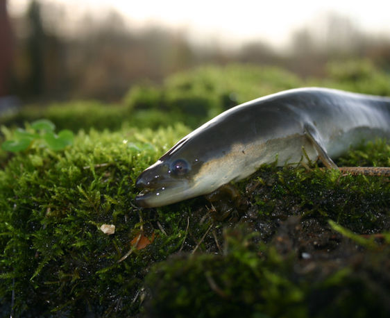
Thames Catchment Community Eels project
The Thames Estuary Partnership and the Zoological Society of London were collaborators on the Thames Catchment Community Eels project, which was led by the Thames Rivers Trust with Action for the River Kennet, South East Rivers Trust and Thames21.
The Thames Eels project engaged and informed communities about eels and rivers, through community and school eel education activities, which ranged from riverbank walks to ‘virtual’ eel workshops. These were covering topics including eel history, life cycle, habitats, pressures and what we can do to help.
As part of this project, the Thames Estuary Partnership:
-
Extended the Fish Migration Roadmap study area with the addition of the Kennet, Loddon and South Chilterns catchments
-
Engaged with stakeholders and local community groups to collect barrier data using the updated River Obstacles app
-
Delivered workshops on the Fish Migration Roadmap and the Fish Migration Vision
-
Delivered workshops on the basics of cartography and GIS
The barrier data collected has been incorporated into the Fish Migration Roadmap and into the Thames Basin Eel Management Plan (EMP) to aid the measures needed to improve the Thames River Basin for eels.


